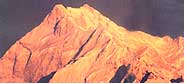
The
Himalaya, roof of the world, is a magic place where the magnificence of
the world's highest mountains is mirrored in the rugged beauty and
unique culture of the people who live in their shadow.
Duration: 06 Nights - 07 Days
Duration: 07 Nights - 08 Days
Duration: 08 Nights - 09 Days
Duration: 09 Nights - 10 Days
Duration: 11 Nights - 12 Days
Duration: 05 Nights - 06 Days
Uttaranchal Glaciers
| Region : |
Garhwal, Uttaranchal |
| Local Name : |
Bamak |
| Altitude Variation : |
5,600m To 6,000m |
| Best Time To Visit : |
Throughout Summer And
Autumn Season. |
Dokriani 'Bamak' is a well-developed medium sized glacier of the
Bhagirathi basin. The glacier is formed by two cirques, originating at the
northern slope of Draupadi Ka Danda and Jaonli Peak, 5,600 m and 6,000 m
respectively. The glacier is 5-km long and flows in the northwest direction
terminating at an elevation of 3,800m.
The stream originating from the glacier's melted water is called "Dingad",
which later joins many other snow/ice-melted streams and finally merges into
Bhagirathi River near Bukki village. There are several well-developed
meadows and proglacial lakes located 2 km below the snout of the glacier.
These meadows, lakes and other formations themselves tell their past history
and behaviour of the glacier and also provide good camping sites.
Approach To The Glacier
The glacier is easily approachable from Uttarkashi. Nearly 56-km from
Uttarkashi on the road to Gangotri, Bukki village is 2-km, from the bus
terminus situated on the right bank of Bhagirathi River. On way to Dokriani
glacier, one has to walk 23-km from the road.
Campsite
After crossing the Bhagirathi river a footpath flows along the steep
mountain slopes up to Tela camp. From Tela to Gujjar hut a 12-km. Run along
the Dingad stream is a route offered to cross the several up and down
ridges, many small and big streams and dense mixed forests of Deodar,
Rhododendron, Oak, Pine, etc. provide an atmosphere of perfect peace and
tranquility.
Overwhelmed by such heart-touching beauty one crosses the way without
difficulties. Gujjar hut (a summer camp of Gujjars with their buffaloes) is
located at a height of 3,500m, just 5-km below the Dokriani glacier. Gujjar
hut is the gateway of the valley. The valley has a gentle slope with
different land features formed by the glacier and surrounded by snow-covered
peaks. This place is good for camping and one can walk up to the glacier and
adjoining areas and climb the small peaks. Only Gujjar huts and a base camp
(near the glacier snout) of Wadia Institute of Himalayan Geology, Dehradun
lie on the way.
One visiting the area has to make his own arrangement for food, tents and
light warm clothes. The best season to visit is throughout Summer and
Autumn. Besides the above two glaciers, Kedar, Rudugaira and Jaonli are some
other glaciers which are approachable by the same way.
Trek: - BASE CAMP NAITALA
Bukki to Dokriani Glacier
Bukki to Bukki village
Bukki to Kheratal
Kheratal to Dokriani glacier
Bukki to Uttarkashi
Uttarkashi to Rishikesh |
23-km
23-km
17-km
5-km
34-km
149-km. |
| Region : |
Garhwal, Uttaranchal |
| Significance : |
Important Glacier of The
Yamuna River Basin |
| Altitude Variation : |
6,316m To 6,387m |
| Best Time To Visit : |
Throughout Summer And
Autumn Season. |
Bandarpunch is an important glacier of Yamuna river basin. The glacier is
12-km long situated on the northern slopes of Bandarpunch Peak (6,316m),
Bandarpunch West (6,102 m) and Khatling peak (6387 m). The glacier is formed
by three cirque glaciers and later joins the Yamuna River. It lies on a
gentle slope and is bounded by lateral moraines, which indicate the last
surface level of the glacier.
Approach To The Glacier
The glacier can be approached from Dehradun to Sankri-Saur by bus and from
Sankri-Saur to Taluka, 11-km by jeep or light vehicle, then Osla, 14-km.
From Osla Ruinsara Tal, located just below the glacier snout, is the best
camping site. From Ruinsara one can visit the glacier and its surrounding
area.
Trek: - BASE CAMP - TALUKA
Taluka to Bandarpunch
Taluka to Seema / Osla
Seema to Bandarpunch
Taluka to Mussoorie
Mussoorie to Dehradun |
23-km
14-km
15-km
171-km
36-km. |
| |
|
| By Road: - |
|
| Dehradun to Taluka |
207-km |
| Region : |
Garhwal, Uttaranchal |
| Significance : |
Important Glacier of The
Yamuna River Basin |
| Altitude Variation : |
6,316m To 6,387m |
| Best Time To Visit : |
Throughout Summer And
Autumn Season. |
This lateral glacier situated in Tehri district is the source of river
Bhilangna. Snow peaks of the Jogin group, Sphetic Pristwar, Barte Kauter
Kirti Stambh and Meru surround the glacier. The moraines on the side of the
glaciers look like standing walls of gravel mud.
Approach To The Glacier
The trek, which starts, from Ghuttu is easily approachable by motor from
Dehradun, Tehri, Mussorie and the Rishikesh railhead. One has to trek about
45--km and pass through remote villages with thick Kharsao forest and
wide-open beautiful lush grassy meadows. The entry to the Bhilangna valley
provides excellent spots for camping. Tents and adequate provisions need to
be arranged in advance from Rishikesh, Tehri and Dehradun.
Trek: - BASE CAMP - GHUTTU
Ghuttu to Reeh
Reeh to Gangi
Gangi to Kalyani
Kalyani to Bhelbagi
Bhelbagi to Khatling |
10-km
10-km
5-km
13-km
7-km. |
| |
|
| By Road: - |
|
| Ghuttu to Tehri |
64-km |
| Tehri to Rishikesh |
83-km |
| |
|
| By Rail :- |
|
| Rishikesh to Khatling |
191-km |
| Region : |
Garhwal, Uttaranchal |
| Lake Formed By Glacier : |
Ganghi Sarovar |
| Altitude Variation : |
600m To 3,800m |
| Best Time To Visit : |
Throughout Summer And
Autumn Season. |
Approach To The Glacier
The glacier is approachable by road upto Gaurikund via Rudraprayag,
Guptkashi and Soneprayag. From Gaurikund, a foot trek runs over the hill
slopes upto Kedarnath temple. From Kedarnath temple, there is a 3-km
footpath to the glacier snout. Between the rock face and right lateral
moraine of the glacier, there is a lake formed by glacier-melted water
called "Ganghi - Sarovar".
Chorbari Bamak glacier is situated in Rudraprayag district of Uttaranchal
the glacier is 6-km. Long and originates from the southern slope of
Kedar-dome, Bhartekhunta and Kirti Stambh and this hill range is the water
divide which separates the gangotri group of glaciers and the Chorbari
glacier. Several hanging glaciers and avalanche chutes feed the glacier. The
lower part of the glacier is covered by thick debris and bounded by huge
deposits of lateral moraines. The glacier starts from its accumulation zone
(600m) and terminates at an elevation of 3,800 m, from where a snow/ ice
melt stream originates, called "Mandakini" and merges into the
Alaknanda River at Rudraprayag.
Trek: - BASE CAMP - GAURIKUND
Gaurikund to Chorbari Glacier
Gaurikund to Rambara
Rambara to Kedarnath
Kedarnath to Chorbari Glacier |
17-km
7-km
7-km
3-km |
| |
|
| By Road: - |
|
| Gaurikund to Rudraprayag |
78-km |
| Rudraprayag to Rishikesh |
143-km |
| |
|
| By Rail :- |
|
| Rishikesh to Chorbari Glacier |
238-km |
| Region : |
Garhwal, Uttaranchal |
| Significance : |
Important Glacier Of
Dhauli Ganga System |
| Altitude Variation : |
5,150m To 4,240m |
| Best Time To Visit : |
Mid May To Mid October |
Doonagiri glacier is one of the important glaciers of Dhauli Ganga system
of glaciers where more than 500 glaciers, of different shapes and sizes lie
in the deep and narrow valleys. The important glaciers here are: Changbang,
Girthi, Hoti and Niti glaciers. Doonagiri glacier is 5.5-km long, extending
between an elevation from it head 5,150m to the snout 4,240m, which is the
terminal point of the glacier. A stream originating from the glacier merges
into Dhauli Ganga near the Juma village.
Approach To The Glacier
The glacier is approachable from Juma on the way to Joshimath-Malari Road.
8-km from Juma lies the Doonagiri village. From Doonagiri village a 12-km
long foot-trek runs along the Doonagiri stream to reach the glacier snout.
Bagini is another glacier in this valley. Doonagiri is the last village in
the valley. Near the vicinity of the glacier there is a good place for
camping. The best time to visit the place is mid May to mid October.
Trek: - BASE CAMP - JUMA VILLAGE
Juma to Doonagiri Glacier
Juma to Doonagiri Village
Doonagiri to Doonagiri Glacier |
20-km
8-km
12-km |
| |
|
| By Road: - |
|
| Juma to Joshimath |
43-km |
| Joshimath to Srinagar |
147-km |
| Srinagar to Rishikesh |
109-km |
| |
|
| By Rail :- |
|
| Rishikesh to Glacier |
319-km |
| Region : |
Garhwal, Uttaranchal |
| Significance : |
Longest Glacier Of
Bhyundar Ganga Basin |
| Best Time To Visit : |
Mid June To Mid October |
Tiprabamak (Bamak is the local name for the glacier) is a 6-km long glacier
of Bhyundar Ganga basin in the Alaknanda catchment. Nearly 16 glaciers of
various sizes and shapes exist in the basin, out of which only Tiprabamak
and adjoining Ratanban glaciers are of significance. The melted water
discharge of these glaciers emerges from a single ice cave at the snout of
the Tiprabamak.
Approach To The Glacier
A thick deposit of debris covers the glacier surface and the upper part of
the glacier is approachable through Joshimath-Badarinath road upto
Govind-Ghat. From Govind-Ghat is a 18-km bridle path, which runs via
Bhiundhar village upto Ghangaria. Further 4-km from Ghangaria, the famous
valley of flowers is located at base of Kagbhusndi range of peaks. Ghangaria
is the only place for staying in this vicinity. The best time to visit the
glacier is mid June to mid October.
Trek: - BASE CAMP - GOVIND GHAT
Govind Ghat to Tiprabamak Glacier
Govind Ghat to Ghangaria
Ghangaria to Valley of Flowers |
20-km
14-km
4- km |
| |
|
| By Road: - |
|
| Govind Ghat to Joshimath |
19-km |
| Goving Ghat to Srinagar |
166-km |
| Srinagar to Rishikesh |
109-km |
| |
|
| By Rail :- |
|
| Railhead Rishikesh to Tiprabamak Glacier |
295-km |
Satopanth, Bhagirathi-Khark Glacier
| Region : |
17-km From Badrinath,
Chamoli District, Garhwal, Uttaranchal |
| Altitude Variation : |
3,810m To 3,820m |
| Best Time To Visit : |
Only In Summer |
The Satopanth and Bhagirathi Kharak are important glaciers in upper
Alaknanda basin and are a source of the river Alaknanda. These glaciers are
located 17-km from the famous temple of Badrinath, in Chamoli district. The
Satopanth glacier is possibly derived from two words; 'Sato'
meaning heaven and 'Panth' stands for path or way.
These glaciers originate from the peaks of Chaukhamba and Badrinath range
of peaks, which separate them from the Gangotri group of glaciers. These
glaciers are 13 and 18 -km long, respectively and terminate at an elevation
of 3,810 m and 3,820m, respectively.
Approach To The Glacier
These glaciers are approachable from Joshimath in the Chamoli sub-division,
by following the Badrinath and Mana (3,128m) motorable road. From Mana the
route follows along the course of the Alaknanda river. A water fall (145 m),
named Vasudhara, lies on the right bank of the Alaknanda at an elevation of
3,250m. from Vasudhara, 5-km upward the snout of the glaciers open. 2-km
down the valley, the left bank of the river is suitable for camping. The
glacier can be approached only in summer.
Trek: - BASE CAMP - BADRINATH
Mana Village
Mana to Satopanth Bhagirathi
Khark glacier |
10-km
|
| |
|
| By Road: - |
|
| Badrinath to Mana |
3-km |
| Badrinath to Srinagar |
191-km |
| Srinagar to Rishikesh |
109-km |
| |
|
| By Rail :- |
|
| Rishikesh to Satopanth,Bhagirathi Glacier |
313-km |